Next members’ meeting:
Monday 15th May, 7.30pm, Union Chapel, Wellington Road, Fallowfield.
Mayor’s Challenge Fund Development and Improvement Project.
We still have not received any official communication from Manchester Council, apart from the project being ‘downgraded’ .Information from the Manchester Walking and Cycling Forum on 14th March, which was attended by a couple of FotFL members, was:
‘Manchester Cycleway (the Fallowfield Loop) – The Safer Streets funded scheme has now commenced with some site clearance underway in the Yellow Brick Road area. Final designs are being prepared for other interventions that include improvements to access points, replacement/reinstatement of some fencing, removal of some barriers/blocks on path and resurfacing. It is expected that these works will be completed by Sept 2023.’
Tim Hollins, the Sustrans Network Development manager in the North West, says that two things that Sustrans are very keen for the Safer Streets Fund to achieve is to improve access barriers and for resurfacing along the two sections at Shillingford Road and from Withington Road to St Werburgh’s tram stop where there is tree root damage. They are currently discussing with MCC about what can be achieved using a mixture of Sustrans maintenance funds and the larger SSF pot. MCC would like the SSF pot to cover the Yellow Brick Road as well as the Floop so we will be asking Oliver Collins (SSF Project Manager) to mediate and make sure that there’s a fair spread of funding.
Safer Streets Funding – our possible input.
Frances McCann reports:
The Friends of the Fallowfield Loop have now linked up with the Safer Streets Funding development worker, Anna Smith. Anna has a 7 hour a week contract (until the end of 2023) to undertake community development work in relation to The Fallowfield Loop. She is making links with schools and community groups, doing promotion work and setting up Loop related activities.
The £453,000 Safer Streets funding is from the Home office. This allocation is managed through joint working of the Greater Manchester Combined Authority, Transport for Greater Manchester and Manchester City Council. In relation to the Fallowfield Loop, Anna is also looking to make contact with Sustrans.
Ian Barker has, on behalf of The Friends of the Fallowfield Loop, sent a list of issues and concerns, particularly in connection to repairs and safety matters that need attention, to the GMCA officer, Oliver Collins, who has oversight of the project development. He has also shared this with Anna Smith.
We hope that Anna will be able to give an update of the work she has been doing for the July Newsletter, it is also hoped that she will be able to come as a guest speaker to the July meeting, Monday 17th July.
David Beetham memorial tree planting.
On the 15th April 40 cyclists took a ride round the orchards and ended up at Station South for tea and cakes. David Beethams’ relatives then ceremonially planted an apple tree in his memory in a large container on the corner of the station site.
Orchards projects.
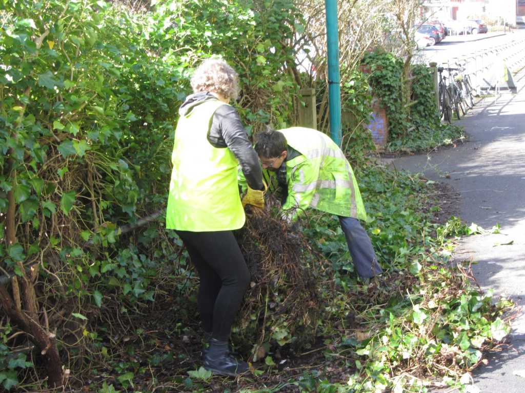
The orchards are looking good at the moment, with a good crop of blossom on most of the trees. Over the next couple of months, the orchard group will be looking to remove ground level weed growth round the trees and larger encroaching vegetation such as brambles and self seeded willow branches.
If you are interested in helping with orchard work please contact Dick Venes via email: rjvenes@waitrose.com.
Quadrants workday
One recent workday Ian Barker’s group re-seeded a bald unofficial path from the Loop to the Station South site. This was the original route of the path which Ian managed to get relocated to preserve the large ‘performance’ area of grass on the north west ‘Quadrant’. Unfortunately we have had no recent contact from the ‘Handlebards’ group who have put on Shakespeare plays on the site in previous years, so if anyone has any ideas about possible arts performances there this coming summer please contact us.
Eddie Johnson talk.
Eddie Johnson, Hon President of the Friends, will be giving an illustrated talk about the Fallowfield Loop railway line on 26th June at the Union Chapel. Please book the date in your diaries – we will be sending out more details in due course.
Nature Walks
The April circular walk from Athol Road and back, via Hough End Fields and Red Lion Brook was well attended and a number of harder to spot birds were heard and seen. These included: willow warbler, blackcap, stock dove, greenfinch and bullfinch.
NB Due to the unavailabilty of walk leaders in May and June, the next walk will not be until July, when we hope to have Fungalpunk Dave return for another exciting Floop Safari !
The future of the Friends
As previously stated, currently we are operating with a soon to retire Chair, no Hon Secretary and a stand-in Hon Treasurer. Past appeals for members to volunteer for Officer positions have failed to attract anyone so far, so we are currently facing disbanding the Friends organisation at the next AGM. If this happens, our Constitution states that ‘ in the event of the dissolution of the Association, once all liabilities have been met, any money or property left over shall be transferred to such charitable organisations as members deem suitable.’ If you are interested in helping the Friends group continue in the future the time to volunteer is now!
If no volunteers come forward, we will likely formally disband the Friends at the September meeting, which will be our AGM. The Hon Treasurer is currently sitting on about £3,000 in our bank account and would like to spend it on something useful on the Loop rather than bequeath it to a related charity. So, if you have any ideas for suitable expenditure, please contact Dick at rjvenes@waitrose.com, or by phone to discuss on 0161 224 3843.